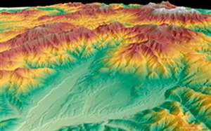
Whether planning an infrastructure network, conducting a military intervention mission in unknown terrains, or analysing terrain features for oil and gas exploration: accurate terrain height information is critical.
Precise and reliable elevation data supports a wide range of applications and forms the foundation of any accurate geospatial product.
With five core product levels GEO Elevation simplifies access and use of elevation data and provides exactly the right models for all project requirements.
The scope of delivery can be adapted to individual needs by choosing to add a set of auxiliary layers or corresponding orthorectified images to the input data. Highly developed digital data processing flow line and a large production capacity allow for unique time and cost-efficient production and delivery.